 Clingmans Dome towers at 6,643 feet and stands as the highest point in the Smoky Mountains National Park, the highest point along the Appalachian Trail, the highest point in Tennessee, and the second highest point east of the Mississippi river.
The Cherokee know the mountain as Kuwahi or Mulberry Place and consider it a sacred place. According to legend, medicine people would come to the mountain to fast and pray, seeking guidance from the Creator, then they would return to the people of Kituhwa with the guidance and instructions.
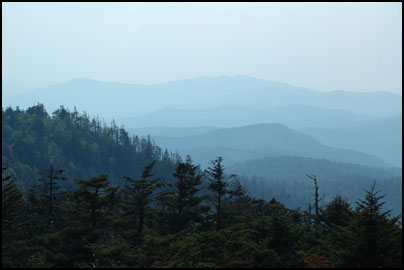
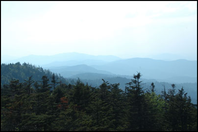
Cherokee myth also includes several stories surrounding this mighty peak. The bears had their townhouse under this peak and here they would gather to dance before retiring to their dens to sleep during the winter months. This peak is also the mythological location of Magic Lake, where sick bears would go to be healed. To our eyes the lake appears as clouds which fill the valleys below.
During Removal, the rugged slopes would serve as refuge for Cherokee’s seeking to escape the forced march to Indian Territory.
Clingmans Dome Travel Details
Although Clingmans Dome is open year-round, the road leading to it is closed from December 1 through March 31, and whenever weather conditions require. From the road and parking lot, visitors will need to hike up a wide paved ramp to reach the overlook. This ramp is a steep half-mile walk, so wear comfortable shoes. Also, the weather at this altitude is more akin to Canada than Tennessee, so dress accordingly before you begin your hike up.
Directions: Clingmans Dome is located in the middle of the Great Smoky Mountains. Take Highway 441 from either Cherokee, NC or Gatlinburg, TN to reach Clingmans Dome Road. For specific directions, click the “Directions” link in the location bubble of the map above and enter your starting location on the left.
GPS & Map: 35.562883661530876,-83.49875450134277